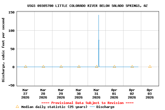
Most recent instantaneous value: 0.00 04-02-2026 20:15 MST
See this graph on the Monitoring Location Pages
| Most Recent Instantaneous Value Apr 3 | Min (2016) | 25th percen- tile | Median | 75th percen- tile | Mean | Max (1985) |
|---|---|---|---|---|---|---|
| 0.00 | 0.00 | 0.62 | 1.3 | 2.2 | 9.6 | 203 |
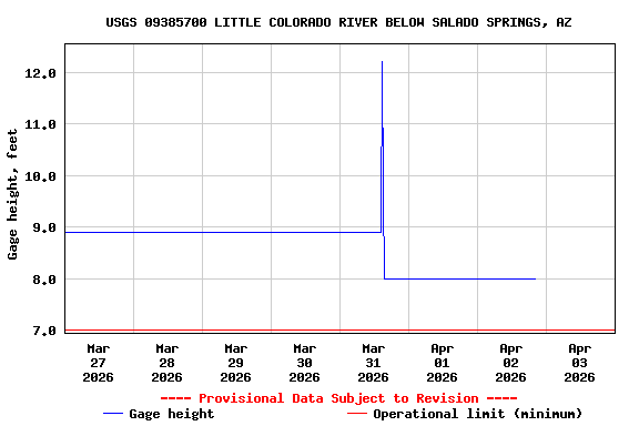
![Graph of Gage height, feet, [Bubbler]](https://natwebsdww01.cr.usgs.gov/nwisweb/data/img/USGS.09385700.6198.00065..20260327.20260403..0..gif)