
New Feature - SensorThings API
Feature used for better dashboard and device integration, real-time data access (less than 120 days old), and location metadata.
SensorThings coming soon to WDFN.
Use the SensorThings API to access national-scale data for quicker application development and the ability to map those results. This API provides users with a flexible way to interconnect data, devices, and application over the Web.
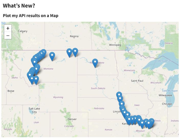
Example of a live call showing the latest result for cubic feet per second discharge on the Missouri River.
The SensorThings API uses a subset of the Sensorthings data model, so you can pick and choose the information you would like to see.
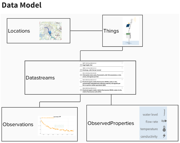
A representation of the USGS implementation of SensorThings at this time. Each Monitoring Location is a Thing, which is at a location. There can be multiple datastreams of data collected at each Thing. Each datastream is tied to a single observed property and multiple observations.
What can I request?
- Locations: The physical location of a Thing.
- Things: A monitoring location or room where a sensor is mounted.
- Datastreams: An entry point for a time series from a Thing with a sensor.
- Observations: A single measurement value.
- ObservedProperties: A description of what is being measured by a sensor at a specific location.
What are my result options?
The SensorThings API provides responses in a standard JSON format but optional parameters can return different formats.
- DataArray
- GeoJSON
- CSV
Questions or Comments?
Our team uses user-centered design processes to determine design and priorities. Let us know if you have any comments about this new tool by emailing wdfn@usgs.gov.
Related Posts
Data Graphs in Water Data for the Nation
June 22, 2023
We have been hard at work designing how to view our water data on graphs in Water Data for the Nation (WDFN). Right now, the primary option is monitoring location pages which have a graph that can look at data over the entire period of record, but this year we’re introducing two additional options to view graphed data!
New Feature - All Graphs
June 6, 2023
We are excited to announce that a new feature is now available to Monitoring Location Pages as part of our modernization efforts. The All Graphs page will show a series of individual graphs of all current sensor data collected at a single location.
New Feature - Explore USGS Water Data
June 6, 2023
Locating and filtering data by specific parameters is coming soon! Explore USGS Water Data provides users with a dynamic tool to customize and throttle targeted information to meet the needs of users.
New Feature - Combined Location Graphs
April 19, 2023
Graphing data for multiple locations on a single graph is here! As part of our modernization effort, we are happy to announce a new page from Water Data for the Nation.
Water Data for the Nation in 2023
April 19, 2023
What is Water Data for the Nation? Water Data for the Nation (WDFN) is the home for USGS’s modernization of public delivery of water data. USGS water data can be accessed by the public in many ways: