
Tips on accessing sediment data
Sediment data are collected on rivers and streams throughout the nation. These data can be accessed through the USGS Samples endpoints.
What's on this page
USGS collects bedload sediment and suspended sediment data at thousands of monitoring locations across the country. These data are useful in understanding water quality conditions and sediment transport in rivers, lakes, and reservoirs throughout the country. We’ve heard from users that it is sometimes hard to find sediment data and fully understand the results presented. We’ve compiled some tips and suggestions to help users find the full amount of sediment data available and understand how these data are collected.
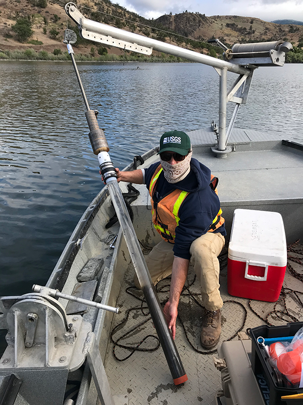
Liam Schenk (USGS Oregon) holding a sediment core collected from the bottom of Iron Gate Reservoir, Klamath River, CA.
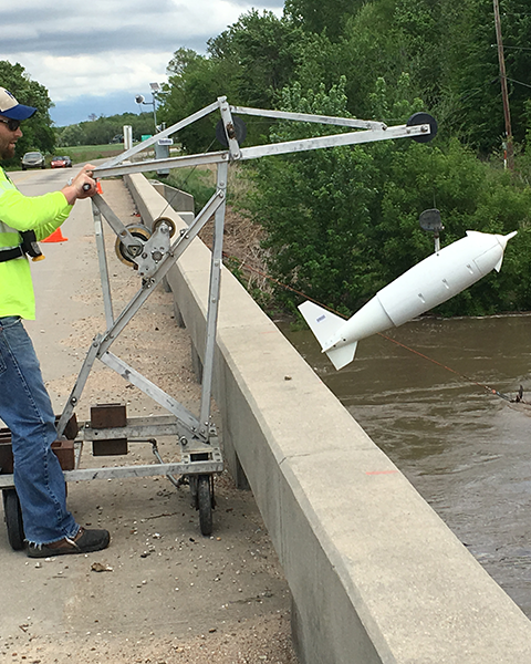
USGS Hydrologist lowers a D-96 sediment sampler into the Neosho River using a small crane from on top a bridge at Burlingame Kansas.
Where to Find Sediment Data
On the web
Sediment sample data are available through the Download Samples feature on WDFN. The Download Samples form allows users to access discrete sample data that are derived from manual field collection and laboratory analysis. Sediment data collection often involves sampling both the sediment itself (such as bed sediment of a specific size) and sampling the water to analyze sediment suspended in the water column.
To ensure that users are accessing all available discrete sediment data for a monitoring location, users should select the Sample Media type as both Sediment and Water. This filter will allow users to see analyses conducted both on water (such as suspended sediment) and analyses on the sediment itself. If users only want to download sediment concentration and class data, they can also refine their search to only look for observed properties in the Sediment characteristic group. These data are available on the Download Samples feature, which means they are also available via the Water Quality Portal
.
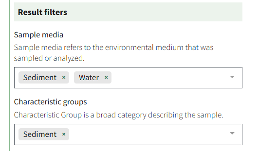
A screenshot from the Download Samples form in WDFN.
Using the dataretrieval packages
Users can also access discrete sediment data directly from a programming console using dataretrieval, available in R
and python
versions. These packages have a set of functions that pull data via the Samples web services
. Below, users will find example data pulls using dataRetrieval and dataretrieval-python. In each language, the first data pull downloads results in hydrologic unit 07090002 where the medium sampled is “Sediment”. The second data pull downloads results in hydrologic unit 07090002 where the medium sampled is “Water” and it is sampled for the characteristic “Sediment”.
R
library(dataRetrieval)

# medium is Sediment, various characteristics
sediment_07090002 <- read_USGS_samples(activityMediaName = "Sediment", hydrologicUnit = "07090002")

# medium is Water, characteristic is Sediment
water_07090002 <- read_USGS_samples(activityMediaName = "Water", characteristic = "Sediment", hydrologicUnit = "07090002")
Python
from dataretrieval import samples

# medium is Sediment, various characteristics
sediment_07090002,_ = samples.get_usgs_samples(activityMediaName="Sediment", hydrologicUnit="07090002")

# medium is Water, characteristic is Sediment
water_07090002,_ = samples.get_usgs_samples(activityMediaName="Water", characteristic="Sediment", hydrologicUnit="07090002")
Please reach out to the Computational Tools team at CompTools@usgs.gov
with questions about using the dataretrieval packages to download sediment data.
Method Metadata Matter
An important consideration in analyzing sediment data is methodology. This information is available as metadata in the discrete sample data downloads. For example, the method used to collect sediment data in the field can range from a cross-sectionally representative sample to a single point or grab sample, both may have different applications and describe different components of a waterbody. The metadata associated with the collection method are available in the SampleCollectionMethod_Name column; some common methods used to collect data are equal-discharge-increment, equal-width-increment
, and grab samples. In addition, the Activity_TypeCode and Activity_MediaSubdivision columns provide insight as to the nature of how a sample was collected and the environmental matrix of the sample.
Another important piece of metadata is how samples were processed in the laboratory
. This information is available in the ResultAnalyticalMethod_Identifier or ResultAnalyticalMethod_Name columns. More information on these methods is available in NWIS Help
, NEMI
, or through several publications about the specific method.
How Sediment Data are Used
It is often useful to combine discharge (streamflow or flow) data with sediment sample data to understand sediment loads. The load values represent how much sediment by volume is being transported in a river and is typically reported as tonnage per time unit. USGS scientists commonly use discharge and sediment samples in combination to calculate daily and instantaneous sediment load values. Sediment load information may help to better understand how sediment may affect reservoir storage, shipping channels, and habitat for example. Although discharge data is sometimes available through the Download Samples feature, discharge data in WDFN are more reliably found as historical observations, daily data, or field measurements in the surface water module of WDFN. Discharge and sample data are also both available via the dataRetrieval package and via USGS water services .
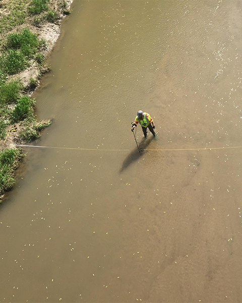
Photo taken from a bridge above a USGS Hydrologist taking a routine streamflow measurement. In the center of the stream suspended sediment can be seen flowing downstream.
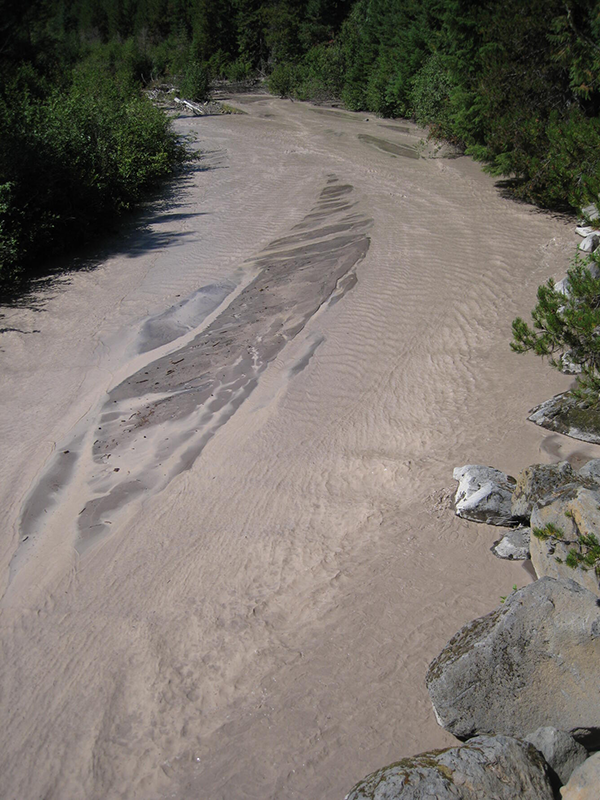
Sediment-laden White River 11 km downstream of the OR35 bridge. Heavy rains resulted in high-sediment loads within this river, which drains Mount Hood, Oregon.
Categories:
Related Posts
A tool to aid in the transition from the legacy NWIS discrete data format to the WQX format
September 15, 2024
Overview
Recently, the USGS modernized the format of its discrete water quality and sample data from a USGS-specific output format to the internationally recognized Water Quality Exchange (WQX) standard (for more background, read this blog post). Over many years, users have come to rely on USGS data from the NWIS
qwwebpage in a particular format for ongoing reporting and data analysis. Making the switch to a new format can be challenging, and we want to support users during this transition period. This blog post describes a resource (spreadsheet ) to help users access and use USGS discrete data in their existing workflows as they transition from legacy to modernized services.WQX3.0 Data Now Available on the Water Quality Portal
May 20, 2024
The Water Quality Portal (WQP) is the largest publicly available water quality data warehouse in the United States. It integrates publicly available data from many providers and outputs those data in a common format, known as the Water Quality Exchange (WQX) standard. Today, it contains hundreds of millions of water quality records from over 2 million locations. Visualizations such as Figure 1 can help to show the distribution of these records across the nation. Hundreds of organizations – including multiple federal agencies, every state and territory, many Tribal Nations, and community science groups – are currently sharing their water quality data with others through the WQP. This important data warehouse integrates and serves diverse physical, chemical, and biological water quality data (observations, measurements, and samples) in a very detailed and common format. The standard used to describe these data has been updated to a new version, WQX3.0. This data exchange standard supersedes prior versions (WQX1.0, WQX2.0, WQX2.1, and WQX2.2).
How the USGS uses the WQX standard
December 27, 2023
Overview
- The Water Quality Exchange (WQX) standard is an internationally recognized data standard that makes it easier to share and use water quality data
- The USGS is expanding its current use of the WQX standard from a relatively coarse mapping for data delivered on the Water Quality Portal (WQP) to a comprehensive mapping of USGS sample data on both the WQP and the modernized USGS data portal, Water Data For the Nation (WDFN)
- Overall, USGS metadata will be more visible to users and it will be human-readable
What is WQX?
The WQX schema is a standardized data exchange format specifically for sharing water quality observational data. This data standard was developed by the Environmental Protection Agency (EPA) in conjunction with the US Geological Survey and other partner environmental organizations. The WQX schema provides a set of metadata attributes that are foundational for understanding ambient water quality observations. Users can define information about who collected samples and where, results and metadata about samples, and information that helps to contextualize results, such as habitat assessment scores and metrics.
Improved Public Delivery of Water Quality and Field Samples Data
August 24, 2023
What are sample data?
Sample data are derived from manual field collection and laboratory analyses, including for water quality, sediment, biological, air and soil samples (waterdata.usgs.gov/nwis/qwdata ). Sample data do not include data collected by continuously-measuring instruments, data from models, or simulated data.
Metadata in Water Data for the Nation
December 29, 2025
Introduction
Metadata are crucial to interpreting and understanding USGS water data. Metadata are data that provides information about other data. They provide important context to the water data you are viewing on WDFN pages or downloading from USGS Water Data APIs . USGS water data metadata includes codes and abbreviations, such as parameter codes, method codes, and observed properties.