
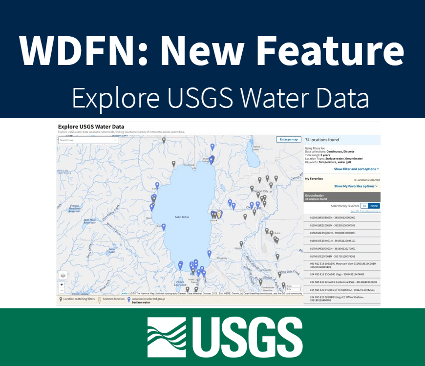
This new feature is used to search and filter through data by locations and data collection categories in WDFN.
Official websites use .gov
A .gov website belongs to an official government organization in the
United States.
Secure .gov websites use HTTPS
A lock (
) or https:// means you’ve safely connected to the .gov website. Share
sensitive information only on official, secure websites.
This new feature is used to search and filter through data by locations and data collection categories in WDFN.

We’ve made changes to the Monitoring Location Page (MLP) to make all kinds of water data accessible from the same place in WDFN.
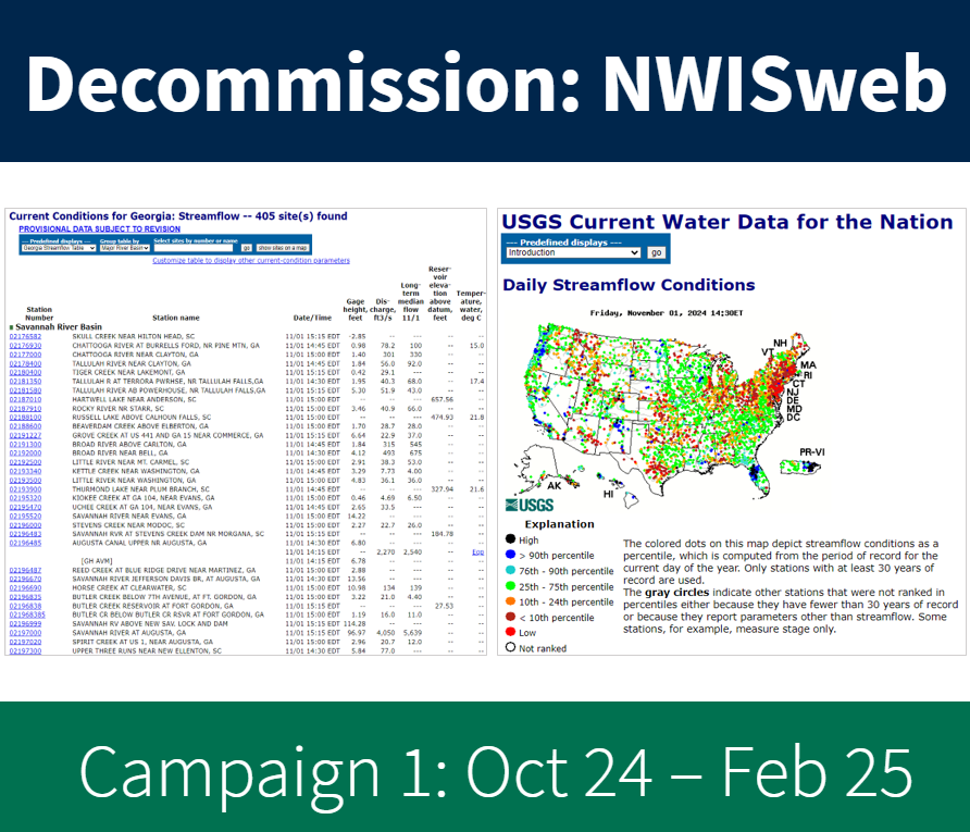
Details of NWISWeb Decommission Campaign 1 from October 2024 to February 2025
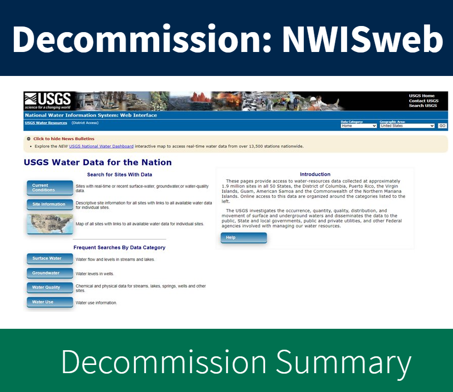
Summary of the NWISWeb webpage decommissions ongoing from October 2024 through February 2027
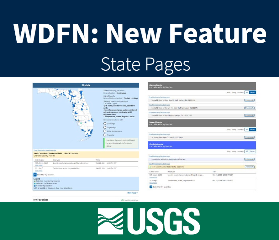
Feature to see current water conditions from all monitoring locations in a state that collect continuous data.
This blog describes a mapping file available to users to ease the transition to the WQX version 3.0 format. The spreadsheet provides high-level mapping of data fields in the legacy NWIS format to WQX fields.
The USGS just released new ways to access water quality and sample data in a recently expanded WQX data format.
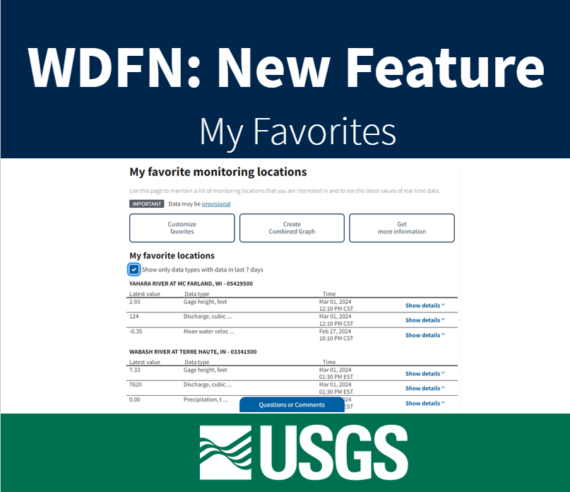
Feature to maintain a list of monitoring locations you are interested in and to see the latest values of real-time data.
The USGS is expanding its implementation of the Water Quality Exchange (WQX) standard for delivering water quality and sample data.
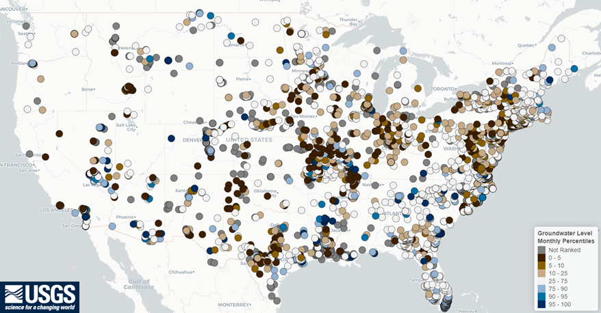
A new, experimental application for viewing groundwater levels with historical context and for generating site-level reports.