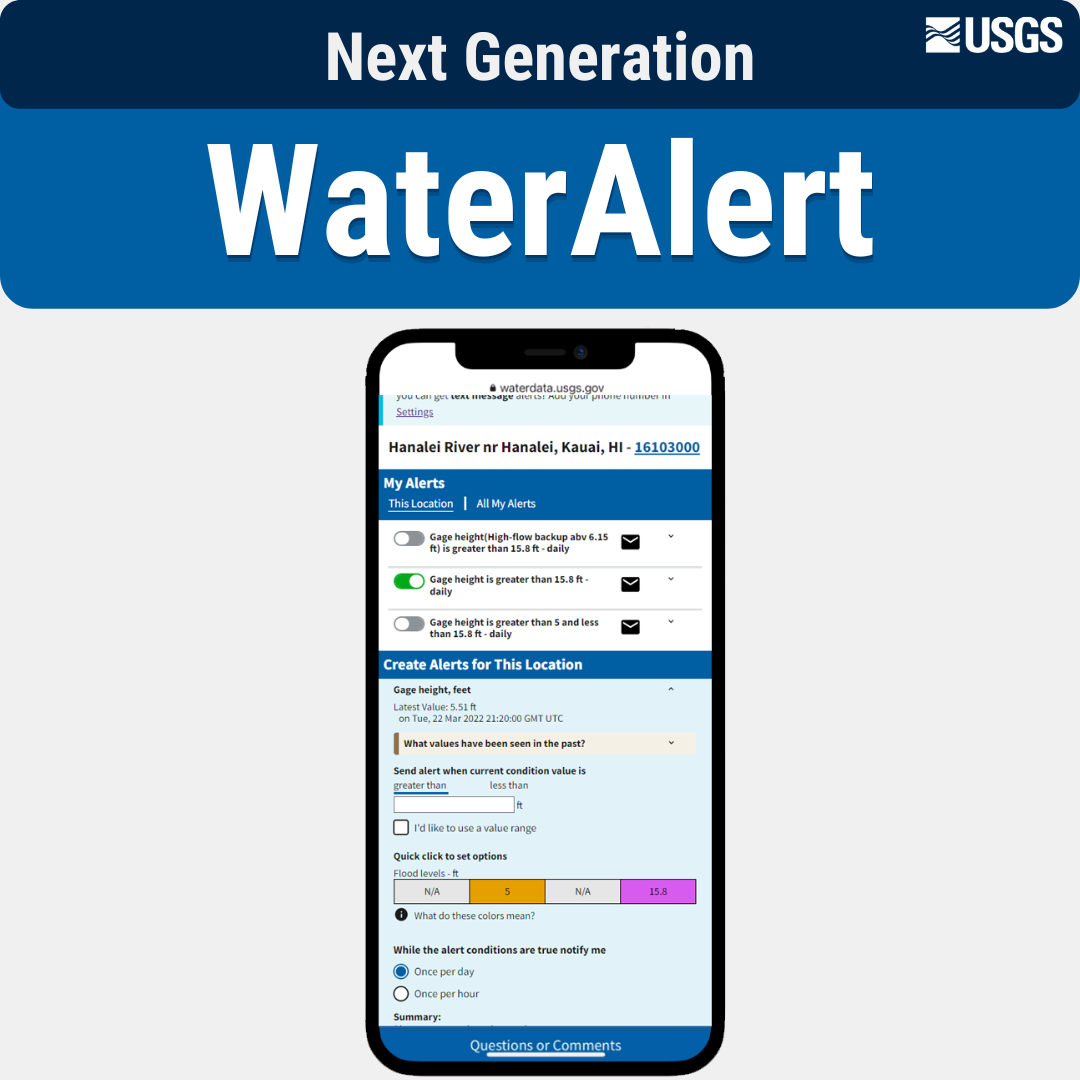
A new, experimental application for viewing groundwater levels with historical context and for generating site-level reports.
Official websites use .gov
A .gov website belongs to an official government organization in the
United States.
Secure .gov websites use HTTPS
A lock (
) or https:// means you’ve safely connected to the .gov website. Share
sensitive information only on official, secure websites.
A new, experimental application for viewing groundwater levels with historical context and for generating site-level reports.
USGS is improving the way that sample data are stored and served to the public. These changes will affect our back-end data management systems, web services, application programming interfaces (APIs), computational tools, and user interfaces for accessing data.
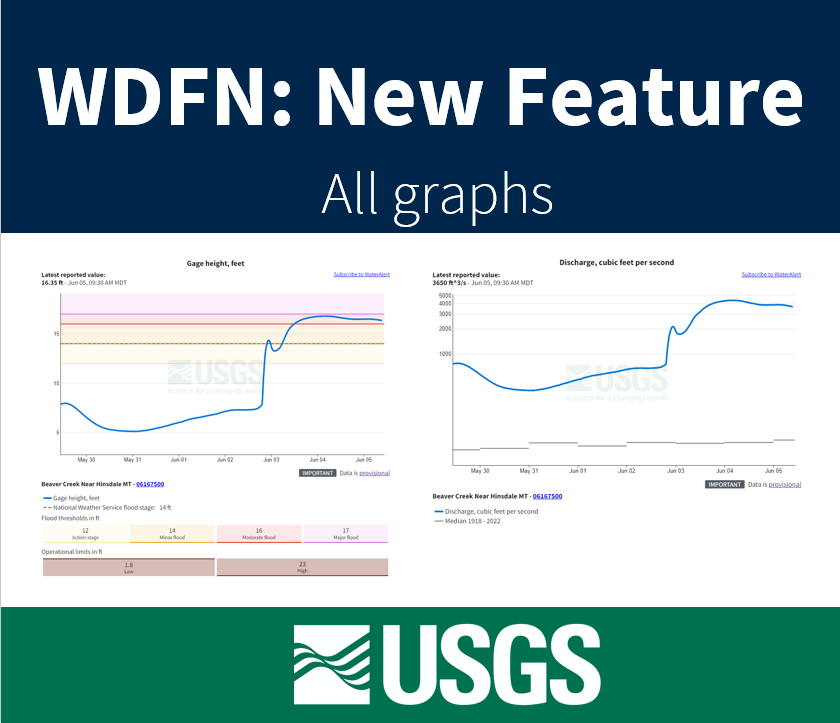
Feature to see a series of graphs of all current sensor data collected at a single location is available now.
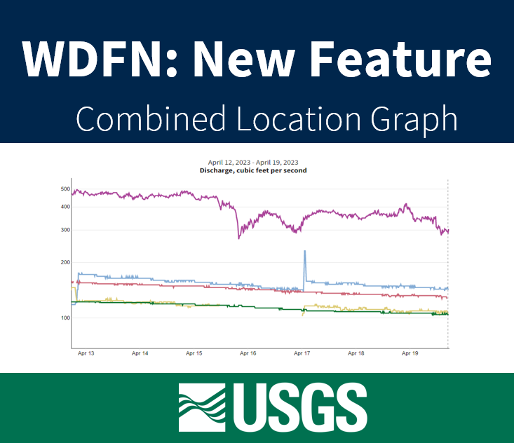
Graphing data for 5 locations on a single graph now available on WDFN
A look into the current and coming soon features available in WDFN. Updated in 2025 to highlight progress and include links to new features
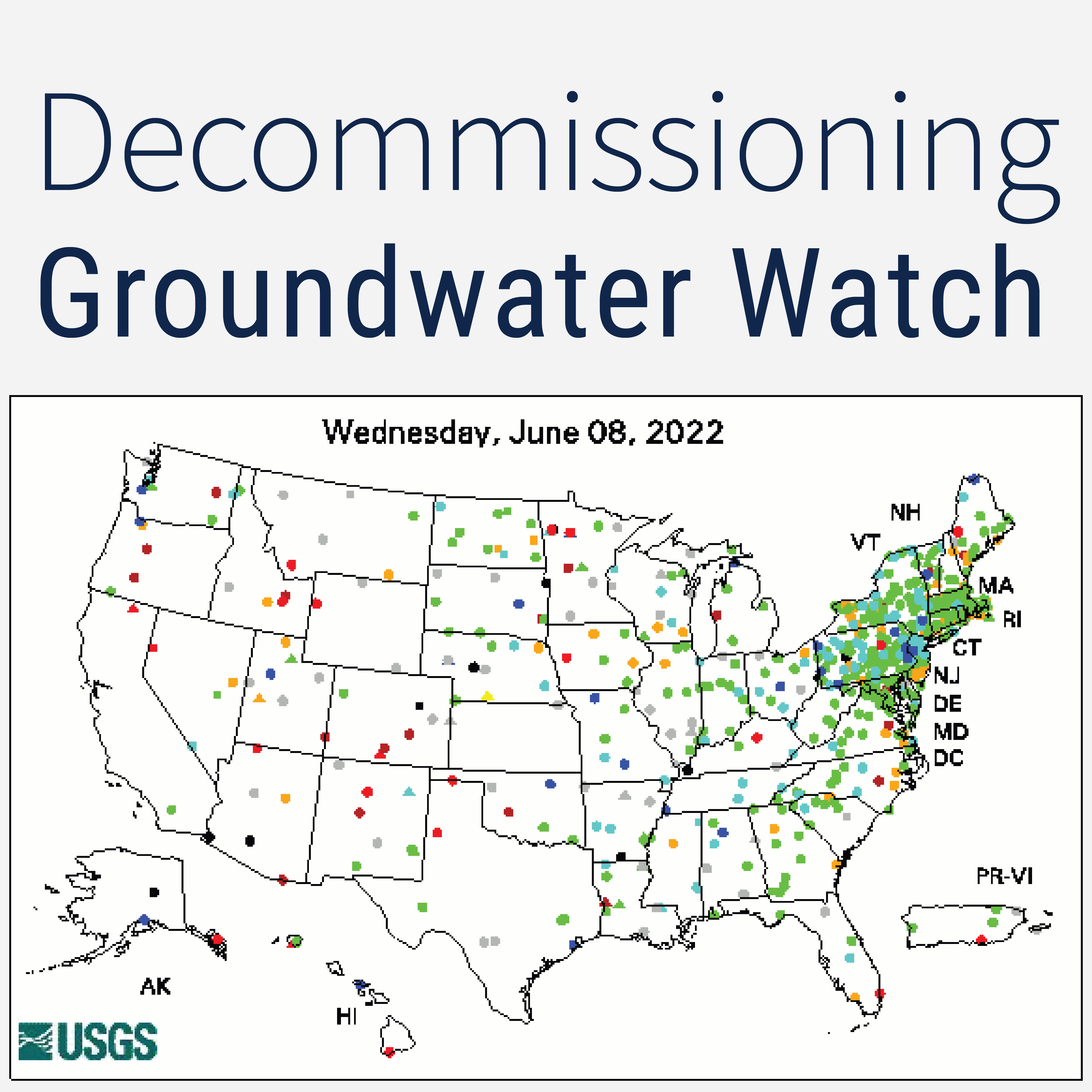
The legacy Groundwater Watch application is being decommissioned. This blog post explains where users can find similar functionality in other publicly available products.
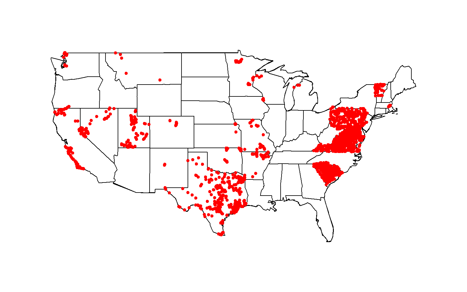
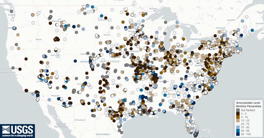
Large pull for all total nitrogen data for streams in the contiguous United States with sites that have at least 40 measurements between 1995 and 2020.
How WDFN is using USWDS to produce mobile friendly and accessible websites
Have you ever heard of user-centered design? We put our users first in how we design, update, and implement our water data delivery products.