Most recent instantaneous value: 1160 02-22-2026 21:00 MST
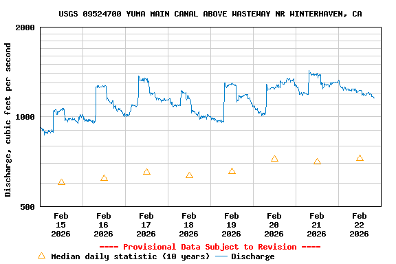
See this graph on the Monitoring Location Pages
| Min (2023) | 25th percen- tile | Median | Mean | 75th percen- tile | Most Recent Instantaneous Value Feb 22 | Max (2024) |
|---|---|---|---|---|---|---|
| 400 | 549 | 725 | 787 | 1110 | 1160 | 1330 |