Most recent instantaneous value: 68.6 03-02-2026 20:15 MST
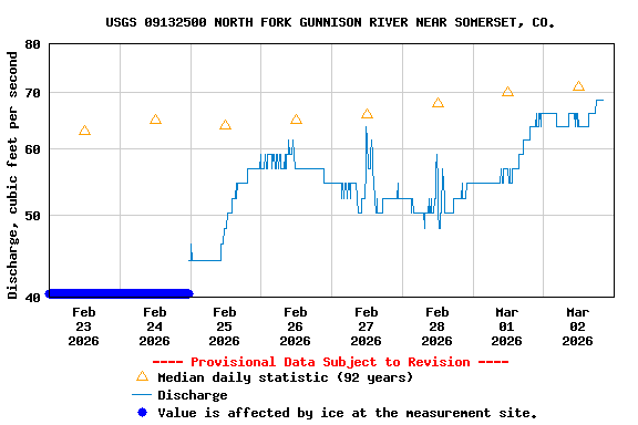
See this graph on the Monitoring Location Pages
| Min (2013) | 25th percen- tile | Most Recent Instantaneous Value Mar 2 | Median | Mean | 75th percen- tile | Max (1985) |
|---|---|---|---|---|---|---|
| 25.8 | 58 | 68.6 | 71 | 89 | 99 | 420 |