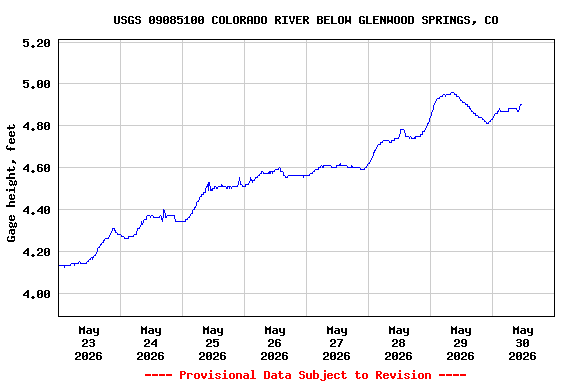
Most recent instantaneous value: 3150 05-30-2026 10:15 MDT
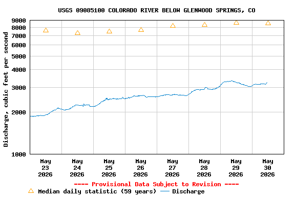
See this graph on the Monitoring Location Pages
| Min (1977) | Most Recent Instantaneous Value May 30 | 25th percen- tile | Median | Mean | 75th percen- tile | Max (1984) |
|---|---|---|---|---|---|---|
| 2100 | 3150 | 6120 | 8540 | 9660 | 12800 | 24900 |