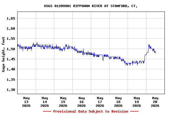
Most recent instantaneous value: 9.21 05-20-2026 12:45 EDT
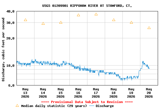
See this graph on the Monitoring Location Pages
| Most Recent Instantaneous Value May 20 | Min (1982) | 25th percen- tile | Median | Mean | 75th percen- tile | Max (1978) |
|---|---|---|---|---|---|---|
| 9.21 | 9.30 | 20 | 26 | 48 | 50 | 203 |