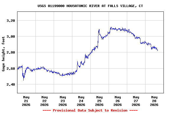
Most recent instantaneous value: 682 05-28-2026 14:15 EDT
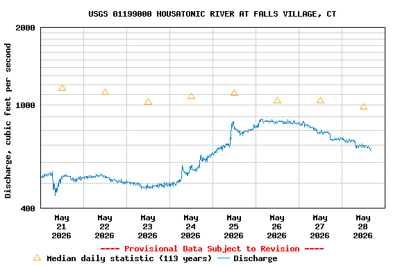
See this graph on the Monitoring Location Pages
| Min (1941) | 25th percen- tile | Most Recent Instantaneous Value May 28 | Median | Mean | 75th percen- tile | Max (1979) |
|---|---|---|---|---|---|---|
| 331 | 649 | 682 | 983 | 1160 | 1500 | 4760 |