LOCATION.--Lat 38°35'40.4", long 75°17'27.7", Sussex County, DE, Hydrologic Unit 02040303, on right
bank on upstream side of bridge on State Highway 24, upstream from Millsboro Pond Dam, at
Millsboro.
DRAINAGE AREA.--61.7 mi2.
REVISIONS HISTORY (WQ).--https://waterdata.usgs.gov/nwis/dv/?site_no=01484525: 2013.
PERIOD OF RECORD.--May 1986 to September 1988. March 1991 to current year.
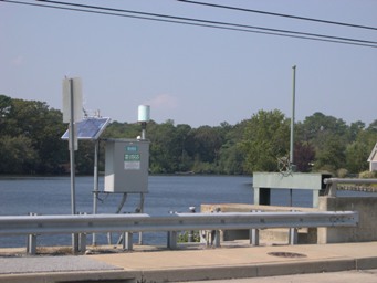
GAGE.--Water-stage recorder, concrete control, and crest-stage gage. Datum of gage is 1.19 ft above
North American Vertical Datum of 1988.
REMARKS.--Outflow from lake controlled by sluice gates at outlet. Natural flow of stream affected
by inflow from sand mine de-watering process. U.S. Geological Survey satellite data-collection
platform at station.
EXTREMES FOR PERIOD OF RECORD.--Maximum discharge, 2,080 ft3/s, Sept. 30, 2016, gage height, 4.95 ft;
minimum discharge, 0.0 ft3/s, no flow, Aug. 29-31, 1998, July 9, 2012.
COOPERATION.--Funding for this station is provided by the Delaware Department of Natural Resources
and Environmental Control through the Delaware Geological Survey, and the U.S. Geological Survey.

