PROVISIONAL DATA SUBJECT TO REVISION
Click to hidestation-specific text
|
This gage is monitored in cooperation with the Southwest Florida Water Management District.
|
Instantaneous-data availability statement
|
This gage is monitored in cooperation with the Southwest Florida Water Management District.
|
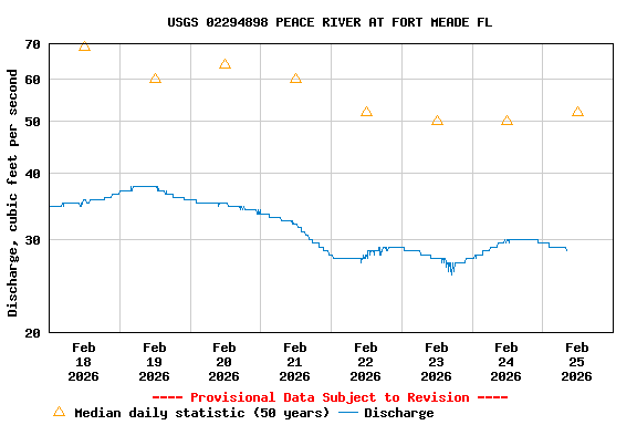
| Min (2001) | Most Recent Instantaneous Value Feb 25 | 25th percen- tile | Median | Mean | 75th percen- tile | Max (1998) |
|---|---|---|---|---|---|---|
| 2.40 | 28.5 | 29 | 52 | 165 | 180 | 2140 |
![]() U.S. Department of the Interior |
U.S. Geological Survey
U.S. Department of the Interior |
U.S. Geological Survey
Title: USGS Current Conditions for Florida
URL:
Page Contact Information: Florida Water Science Center - Tampa Water Data Support Team
Page Last Modified: 2026-02-25 08:37:03 EST
1.26 0.96 vaww01