PROVISIONAL DATA SUBJECT TO REVISION
Click to hidestation-specific text
 Site Information
Summary of all available data for this site
Instantaneous-data availability statement

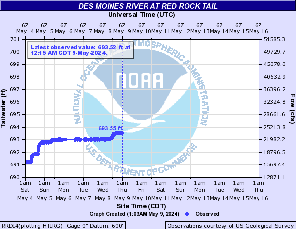
| Min (2014) | 25th percen- tile | Most Recent Instantaneous Value Mar 6 | Median | Mean | 75th percen- tile | Max (2008) |
|---|---|---|---|---|---|---|
| 342 | 2960 | 4890 | 4910 | 6710 | 10400 | 22200 |
![]() U.S. Department of the Interior |
U.S. Geological Survey
U.S. Department of the Interior |
U.S. Geological Survey
Title: USGS Current Conditions for Iowa
URL:
Page Contact Information: Iowa Water Data Support Team
Page Last Modified: 2026-03-06 02:49:50 EST
2.43 2.09 vaww02