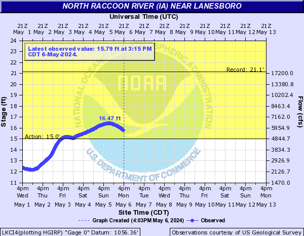
LOCATION.--Lat 42°10'08.7", long 94°43'33.7"
referenced to North American Datum of 1983, in SW 1/4 SW 1/4 NW 1/4
sec.17, T.85 N., R.33 W., Carroll County, IA, Hydrologic Unit
07100006, on left bank 15 ft downstream from bridge on State Highway
286, 1.5 mi southeast of Lanesboro, 1.5 mi downstream from Elk Run,
0.5 mi upstream from Morrowbone Creek, 98.5 mi upstream from mouth,
and 129 mi upstream from mouth of Raccoon River. (map)
DRAINAGE AREA.--1,238 mi2.
SURFACE-WATER RECORDS
PERIOD OF RECORD.--Stage-only records from March 2009 to current
year (no winter records).
GAGE.--Water-stage recorder. Datum of gage is 1,055.88 ft above
North American Vertical Datum of 1988.
 National Weather Service River
Forecast
 Advanced
Hydrologic Prediction Service