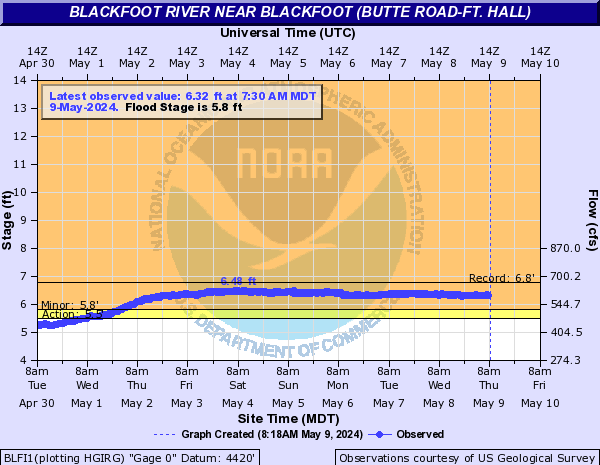
PROVISIONAL DATA SUBJECT TO REVISION
Click to hidestation-specific text
 Rating Information
Station is operated in cooperation with:


Summary of all available data for this site
Instantaneous-data availability statement
Temperature, water, degrees Celsius |
||
|
||

| Min (1993) | Most Recent Instantaneous Value Mar 12 | 25th percen- tile | Median | Mean | 75th percen- tile | Max (1986) |
|---|---|---|---|---|---|---|
| 38.0 | 55.1 | 81 | 101 | 134 | 180 | 386 |

![]() U.S. Department of the Interior |
U.S. Geological Survey
U.S. Department of the Interior |
U.S. Geological Survey
Title: USGS Current Conditions for Idaho
URL:
Page Contact Information: Idaho Water Data Support Team
Page Last Modified: 2026-03-12 21:48:23 EDT
3.67 2.99 vaww02