Page Loading - Please Wait...
LOCATION.--Lat 44° 04'00", long 113° 50'25"(Rev.)(NAD83), in NE1/4 SW1/4 sec.34, T.9 N., R.22 E., Custer County, Hydrologic Unit 17040218, Elkhorn Creek quad., on downstream side of left bank abutment of highway bridge, 0.7 mi upstream from mouth, 3 mi downstream from damsite of Thousand Springs Irrigation and Land Co., and 2.5 mi southeast of Chilly.
DRAINAGE AREA.--145 mi2.
PERIOD OF RECORD.--May 1920 to September 1922 (discontinued). December 1912 to February 1913, and January to September 1914, at site 2.75 mi upstream. Except for a few small springs, which enter between, flows are comparable.
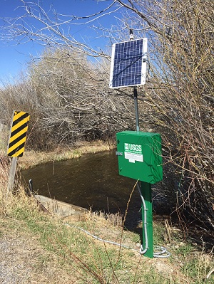
GAGE.--Staff gage. Elevation of gage is 6,220 ft above NGVD of 1929, from topographic map. Nov. 26, 1912 to Feb. 28, 1913, and Jan. 25 to Sept. 30, 1914, staff gage 2.75 mi upstream at different datum.
REMARKS.--Some diversions for irrigation above station; amount diverted unknown.
COOPERATION.--Several discharge measurements furnished by water commissioner for Big Lost River.
EXTREMES FOR PERIOD OF RECORD.--Maximum discharge observed, 85 ft3/s Aug. 18, 1922,
gage height, 1.63 ft; minimum observed, 1.0 ft3/s Dec. 22, 1912, gage height,
2.7 ft.
Most Recent Instantaneous Value Feb 25 | Mean | Min (2020) | Median | Max (2020) |
---|---|---|---|---|
-- unavailable -- | 5 | 5.03 | 5 | 5.03 |