PROVISIONAL DATA SUBJECT TO REVISION
Click to hidestation-specific text
 Rating Information
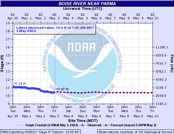

Station operated with funding provided by the Groundwater and Streamflow Information Program (GWSIP) , the Idaho Department of Environmental Quality (DEQ) and the Lower Boise Watershed Council .
Summary of all available data for this site
Instantaneous-data availability statement

