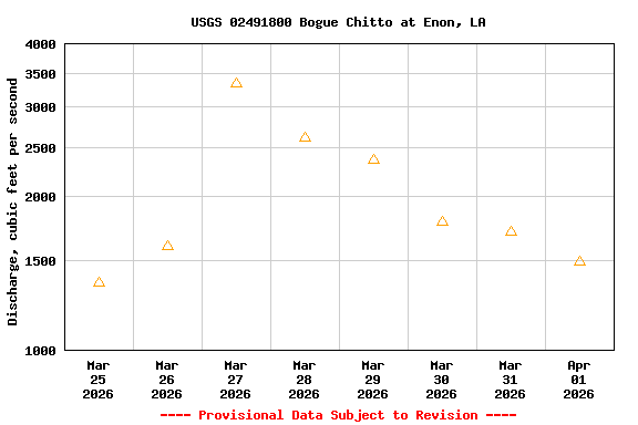
Most recent instantaneous value: 586 10-15-2024 10:30 CDT
See this graph on the Monitoring Location Pages
| Most Recent Instantaneous Value Apr 1 | Min (2023) | 25th percen- tile | Median | Mean | 75th percen- tile | Max (2022) |
|---|---|---|---|---|---|---|
| -- unavailable -- | 1330 | 1330 | 1490 | 2070 | 3380 | 3380 |
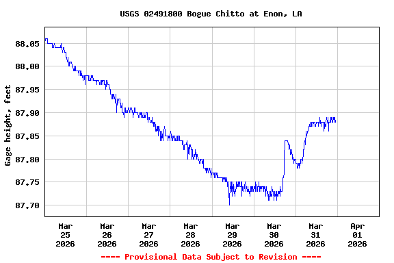
![Graph of Stream water level elevation above NAVD 1988, in feet, [NAVD88 GEOID18]](https://natwebvaww02.er.usgs.gov/nwisweb/data/img/USGS.02491800.309482.63160..20260325.20260401..0..gif)