Most recent instantaneous value: 84.3 10-06-2024 05:45 EDT
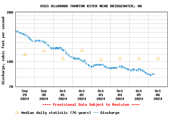
See this graph on the Monitoring Location Pages
| Min (1931) | 25th percen- tile | Most Recent Instantaneous Value Oct 6 | Median | Mean | 75th percen- tile | Max (2022) |
|---|---|---|---|---|---|---|
| 26.0 | 71 | 84.3 | 104 | 207 | 279 | 1360 |