LOCATION.--Lat 39°27'06.8", long 76°57'19.1", Carroll County, MD, Hydrologic Unit 02060003,
on right downstream wingwall of bridge on London Bridge Road, 1.4 mi southwest of Gamber,
and 1.65 mi south of the intersection of Maryland Route 32, and 1.7 mi west of Louisville.
DRAINAGE AREA.--28.0 mi2.
PERIOD OF RECORD.--October 1982 to current year.
REVISIONS HISTORY.--WDR MD-DE-84: 1983(P).
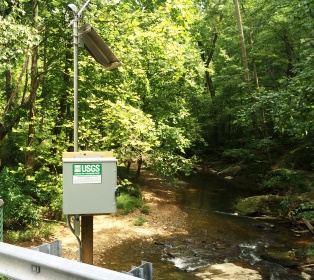
GAGE.--Water-stage recorder and crest-stage gage. Datum of gage is 422.00 ft above North
American Vertical Datum of 1988.
REMARKS.--U.S. Geological Survey satellite data-collection platform at station. Water-quality
records for some prior periods have been collected at this location.
EXTREMES FOR PERIOD OF RECORD.--Maximum discharge, 4,810 ft3/s, Aug. 4, 2018, gage height, 10.71 ft;
minimum discharge, 0.73 ft3/s, Aug. 21-23, 2002.
COOPERATION.--Funding for the operation of this station is provided by the Baltimore City
Department of Public Works, and the U.S. Geological Survey.

