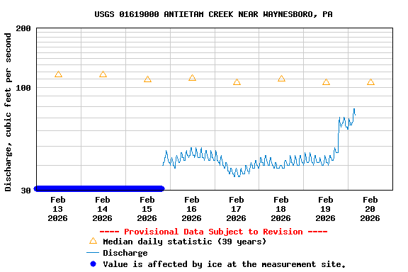
PROVISIONAL DATA SUBJECT TO REVISION
Click to hidestation-specific text

LOCATION.--Lat 39°42'58.5", long 77°36'23.9", Washington County, MD, Hydrologic Unit 02070004,
   on right bank 100 ft upstream from highway bridge at Rocky Forge, 0.4 mi downstream from
   Pennsylvania-Maryland State line, 0.7 mi downstream from confluence of West and East Branch Antietam Creek,
   1.9 mi northeast of Leitersburg, MD, 2.5 mi southwest of Waynesboro, PA and 36.6 mi upstream from mouth.
DRAINAGE AREA.--93.5 mi2.
PERIOD OF RECORD.-- May 1948 to September 1951, October 1965 to September 1981, June 2005 to current year.
GAGE.--Water-stage recorder, crest-stage gage and concrete control.  Datum of gage 536.15 feet above North American Vertical
   Datum of 1988. Former datum (536.59 ft above NGVD 1929) could not be recovered when gage was re-established in 2005.
REMARKS.--U.S. Geological Survey satellite data-collection platform at station. Small fluctuations in flow due to batch
   discharges from the Washington Borough Sewage Treatment Plant, upstream from gage, on East Branch of Antietam Creek.
EXTREMES FOR PERIOD OF RECORD.--Maximum discharge, 5,430 ft3/s, June 22, 1972,
   gage height, 12.33 ft (at previous gage datum); minimum discharge, unknown.
COOPERATION.--Funding for the operation of this station is provided by the U.S. Environmental Protection Agency
   and the U.S. Geological Survey.
| Boating safety tips |
Summary of all available data for this site
Instantaneous-data availability statement
