PROVISIONAL DATA SUBJECT TO REVISION
Click to hidestation-specific text
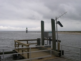
LOCATION.--Lat 39°03'29.9", long 75°23'51.4", Kent County, DE, Hydrologic Unit 02040207, at Bowers Beach,
    on left bank, southeast corner of public pier, 10 feet west of triple public boat ramp, and about 500 feet upstream
    of mouth.
DRAINAGE AREA.--104 mi2.
PERIOD OF RECORD.--July 1965 to October 1990 (crest-stage gage only), October 1996 to November 2006 (stage only),
   November 2006 to June 2009 (stage and discharge), June 2009 to November 2011 (stage only), November 2011 to September
   2016 (stage and discharge), October 2016 to current year (stage only).
REVISIONS HISTORY.--Gage heights for the period of Feb. 27, 2018 to June 12, 2019 were revised based on a documented
   difference to a gage-height correction originally applied during the listed period.
   https://nwis.waterdata.usgs.gov/md/nwis/uv?site_no=01484085: 2018-2019.
GAGE.--Water-stage recorder. Datum of gage is 0.00 ft above North American Vertical Datum of 1988. (Mean Low-Low Water:
   Gage Datum + 2.40 ft) October 2011 to current year. Prior to October 2011, datum of gage was 0.00 ft above National
   Geodetic Vertical Datum of 1929. July 1965 to July 22, 1984, at site 500 ft upstream at same datum (NGVD 29).
   July 23, 1984 to October 1990, and October 17, 1996 to September 21, 2006, at site 500 ft upstream at datum 1.02 ft
   higher (NGVD 29). September 22, 2006 to September 30, 2009, at present site at datum 1.02 ft higher (NGVD 29).
REMARKS.--U.S. Geological Survey satellite data-collection platform at station.
CRITICAL LEVELS.--Top of pier; 5.0 ft, information provided by U.S. Geological Survey.
EXTREMES FOR PERIOD OF RECORD.--Maximum tidal gage height, 7.80 ft (NAVD88), May 12, 2008; minimum tidal gage height,
   unknown. Maximum discharge, 11,200 ft3/s, October 30, 2012; minimum discharge, -19,300 ft3/s, January 23, 2016.
EXTREMES OUTSIDE PERIOD OF RECORD.--Storm of March 3, 1994 reached a stage of 8.24 ft (NAVD 88). Storm of Jan. 4, 1992
   reached a stage of 7.97 ft (NAVD 88). Storm of March 1962 reached a stage of 7.96 ft (NAVD 88), from floodmark.
COOPERATION.--Funding for the operation of this station is provided by the Delaware Geological Survey.
Summary of all available data for this site
Instantaneous-data availability statement
![Graph of Gage height, feet, [NAVD88]](https://natwebvaww01.er.usgs.gov/nwisweb/data/img/USGS.01484085.69431.00065..20260327.20260403..0..gif)