USGS 04156000 TITTABAWASSEE RIVER AT MIDLAND, MI

PROVISIONAL DATA SUBJECT TO REVISION

Click to hidestation-specific text

The Water-Year Summary provides additional information for most sites, and can be accessed via the "Available data for this site" drop-down list.

Station operated in cooperation with the Michigan Department of Environment, Great Lakes and Energy, Dow Chemical Company, and Midland Cogeneration Venture.


This station managed by the GRAYLING FIELD OFFICE.

Available Parameters Available Period
  
1989-09-30  2026-02-19
1989-09-30  2026-02-19
2020-10-16  2026-02-19


 (7)
 

  -- or --


Summary of all available data for this site
Instantaneous-data availability statement


Discharge, cubic feet per second

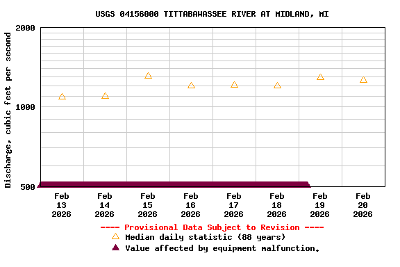
Most recent instantaneous value: Eqp 02-19-2026   04:30 EST
Graph of  Discharge, cubic feet per second

Add up to 2 more sites and replot for "Discharge, cubic feet per second"

?


Create presentation-quality / stand-alone graph.   Subscribe to WaterAlert      

See this graph on the Monitoring Location Pages


Daily discharge, cubic feet per second -- statistics for Feb 20 based on 88 water years of record more
Most Recent
Instantaneous
Value Feb 20
Min
(1944)
25th
percen-
tile
Median Mean 75th
percen-
tile
Max
(1981)
-- unavailable -- 317 771 1260 1950 2160 10000