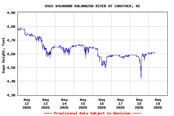
Most recent instantaneous value: 985 05-19-2026 07:15 EST
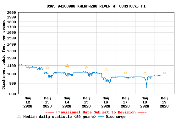
See this graph on the Monitoring Location Pages
| Min (1931) | 25th percen- tile | Most Recent Instantaneous Value May 19 | Median | Mean | 75th percen- tile | Max (2018) |
|---|---|---|---|---|---|---|
| 330 | 788 | 985 | 1020 | 1220 | 1480 | 3660 |