Page Loading - Please Wait...
Streamflow Measurements for Montana
Questions or concerns about USGS data and data products in Montana and Wyoming can be directed to the Wyoming-Montana Water Science Center Data Management Section.
| HTML table with channel data |
| HTML table without channel data |
| Tab-separated data with channel data |
| Tab-separated data without channel data |
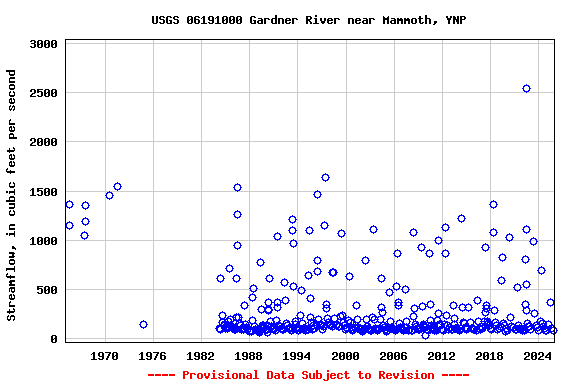
| Graph of data |
| Reselect output format |
![]() U.S. Department of the Interior |
U.S. Geological Survey
U.S. Department of the Interior |
U.S. Geological Survey
Title: Surface Water for Montana: Streamflow Measurements
URL:
Page Contact Information: Montana Water Data Support Team
Page Last Modified: 2025-12-02 00:53:28 EST
0.72 0.62 vaww01