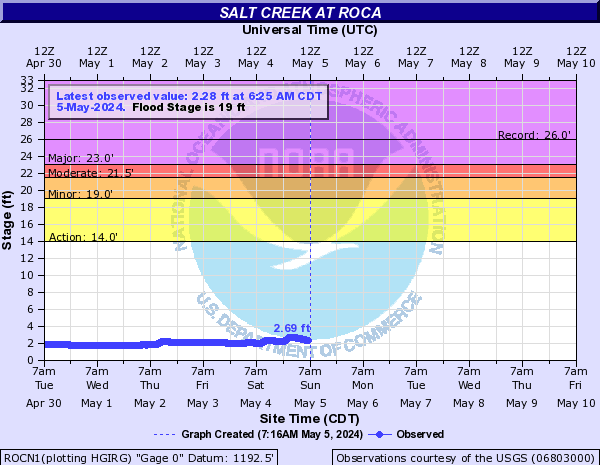
PROVISIONAL DATA SUBJECT TO REVISION
Click to hidestation-specific text
| Funding for this site is provided by | ||
 |
 |
|
| Lancaster County | Lower Platte South Natural Resources District |
National Streamflow Information Program |
 WaterNow – get the latest
gage data from your mobile phone or email.
WaterNow – get the latest
gage data from your mobile phone or email.

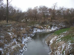
Upstream view from USGS gaging station: Salt Creek at Roca, Nebr.
| Salt Creek Basin |
|
Summary of all available data for this site
Instantaneous-data availability statement
![Graph of Discharge, cubic feet per second, [Discharge from Primary Sensor]](https://natwebvaww01.er.usgs.gov/nwisweb/data/img/USGS.06803000.94783.00060..20260220.20260227.log.0.p50.gif)