PROVISIONAL DATA SUBJECT TO REVISION
Click to hidestation-specific text
| Funding for this site is provided by | ||
 |
 |
 |
| Lancaster County | Lower Platte South Natural Resources District | Cooperative Water Program |
 WaterNow – get the latest
gage data from your mobile phone or email.
WaterNow – get the latest
gage data from your mobile phone or email.


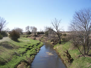
Downstream view near USGS gaging station: Little Salt Creek near Lincoln, Nebr.
 |
Salt Creek Basin |
 |
Summary of all available data for this site
Instantaneous-data availability statement


