Most recent instantaneous value: 364 05-22-2026 05:15 EDT
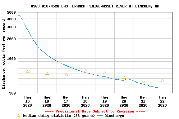
See this graph on the Monitoring Location Pages
| Min (1998) | 25th percen- tile | Most Recent Instantaneous Value May 22 | Median | Mean | 75th percen- tile | Max (2020) |
|---|---|---|---|---|---|---|
| 188 | 336 | 364 | 455 | 559 | 693 | 1480 |