PROVISIONAL DATA SUBJECT TO REVISION
Click to hidestation-specific text
 STATION.--01548303 Straight Run, Site 1, at Marsh
Creek, PA
STATION.--01548303 Straight Run, Site 1, at Marsh
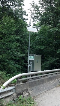
Creek, PALOCATION.--Lat 41`47'05", long 77`24'08", referenced to North American Datum of 1929, Tioga County, Hydrologic Unit 02050205, located on right, at upstream end of bridge spanning Straight Run, on Township Road T452 (Straight Run Road), 0.9 mi upstream from mouth.
DRAINAGE AREA.--6.48 square miles.
PERIOD OF RECORD.--July 1984 to September 1985, July 2012 to October 2017 (discontinued).
GAGE.--Water-stage recorder and water-quality monitor. Datum of gage is 1,220.00 ft above National Geodetic Vertical Datum of 1929, from topographic map.
COOPERATION.--Funding for the operation of this station is provided by the U.S. Geological Survey.
Summary of all available data for this site
Instantaneous-data availability statement