Warning: Javascript must be enabled to use all the features on this page!


Page Loading - Please Wait...

Click to hideNews Bulletins

USGS 02359000 CHIPOLA RIVER NR ALTHA, FLA.

PROVISIONAL DATA SUBJECT TO REVISION

Click to hidestation-specific text

This gage is monitored in cooperation with the Florida Department of Environmental Protection and in collaboration with Nestle Waters North America, Inc.

Link to the Florida Department of Environmental Protection. Link to the Nestle Waters North America.

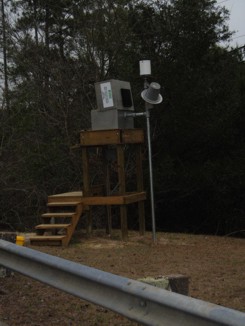
Gage structure-January 04, 2007. Link to the Department of Environmental Protection.

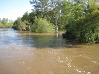
High water from April 3, 2009. Link to the Department of Environmental Protection.

Available Parameters Period of Record
  
2012-10-01  2024-11-20
1912-12-01  2024-11-20
1971-10-01  2024-11-20


 (365)
 

  -- or --


Summary of all available data for this site
Instantaneous-data availability statement

Precipitation, total, inches


Graph of DAILY Precipitation, total, inches

Add up to 2 more sites and replot for "Precipitation, total, inches"

?


Create presentation-quality graph.  


Discharge, cubic feet per second


Graph of DAILY Discharge, cubic feet per second

Add up to 2 more sites and replot for "Discharge, cubic feet per second"

?


Create presentation-quality graph.  


Gage height, feet


Graph of DAILY Gage height, feet

Add up to 2 more sites and replot for "Gage height, feet"

?


Create presentation-quality graph.