Funding for this site is provided by:
 STATION.
--01467042 PENNYPACK CREEK AT PINE ROAD, AT
PHILADELPHIA, PA
LOCATION.--Lat 40`05'23", long
75`04'10", Philadelphia County, Hydrologic Unit 02040202, on
right bank 20 ft below Pine Road, 300 ft upstream from Stream
"A" at north city limits of Philadelphia.
DRAINAGE AREA.--37.9 square miles.
PERIOD OF RECORD.--August 1964 to September 1974,
September 2007 to current year.
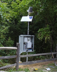
GAGE.--Water-stage recorder, crest-stage gage, and
water-quality monitor. Datum of gage is 79.5 ft. above North American
Vertical Datum of 1988, from single-base GNSS rapid static survey.
Prior to 2007, gage located 100 ft downstream at same datum. Prior to
April 2, 2024, the datum was erroneously reported as 80.41 ft above
National Geodetic Vertical Datum of 1929. Satellite telemetry at
station.
COOPERATION.--Station established and maintained by
the U.S. Geological Survey. Funding for this station is provided by the
City of Philadelphia, Water Department and the U.S. Geological
Survey.
REMARKS.--
Calibration
of water-quality instrumentation is conducted exclusively by
Philadelphia Water Department personnel with USGS oversight. Erroneous
or missing data, resulting from instrument malfunction, are not the
responsibility of USGS.

