LOCATION.--Lat 42°07'37.6", long
76°16'12.4" referenced to North American Datum of
1983, Tioga County, NY, Hydrologic Unit 02050103, on left bank
at downstream side of bridge on State Highway 96, 0.5 mi
upstream from Catatonk Creek, and 1.5 mi north of Owego.
DRAINAGE AREA.--185 mi².
PERIOD OF RECORD.--Continuous record--January 1930 to
September 1978, October 2017 to current year. Annual maximum
only--1979 to 2017.
REVISIONS HISTORY.--WDR NY-83-3: 1981-82 (M). The
maximum discharge for water years 2012-15, 2018 was revised on
Dec. 9, 2020, based on changes to the stage-discharge rating.
Discharge for the period Sept. 17 to Sept. 19, 2018, was
revised on Dec. 9, 2020, based on changes to the
stage-discharge rating.
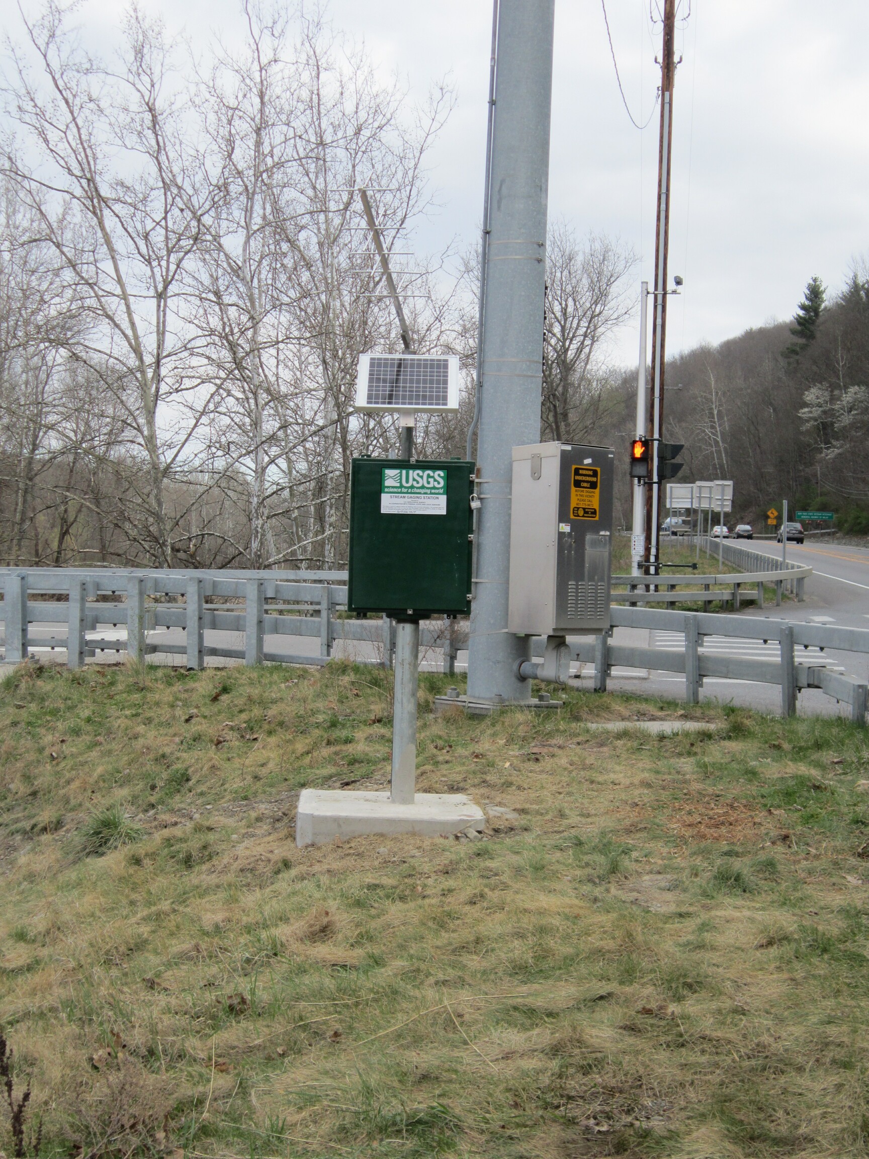
GAGE.--Water-stage recorder and crest-stage gage. Datum
of gage is 819.82 ft above NGVD of 1929 and 819.43 ft above
NAVD of 1988. Prior to July 9, 1935, water-stage recorder, and
July 9, 1935, to Sept. 30, 1936, wire-weight gage at site 50 ft
upstream from Route 96 bridge at datum 1.0 ft higher. Oct. 1,
1936 to Sept. 30, 1962, water-stage recorder at site 300 ft
upstream from Route 96 bridge at datum 1.0 ft higher. Oct. 1,
1962 to Sept. 30, 1978, water-stage recorder, and Oct. 1, 1978
to March 31, 2012, nonrecording gage at site 300 ft upstream
from Route 96 bridge at present datum.
REMARKS.--Water Years 2018-23: Records good except those
for estimated daily discharges, which are poor.
EXTREMES FOR PERIOD OF RECORD.--Maximum discharge,
23,500 ft³/s, July 8, 1935, gage height, 11.50 ft, present
datum, from floodmarks, on basis of slope-area measurement of
peak flow; maximum gage height, 13.05 ft, present datum, Sept.
8, 2011; minimum discharge, 8.1 ft³/s, Aug. 13, 1965; minimum
gage height, 0.12 ft, present site and datum, Sept. 29, 30,
2019.

 Site Information
 WaterAlert – get an
email or text (SMS) alert based on your chosen threshold.
WaterAlert – get an
email or text (SMS) alert based on your chosen threshold.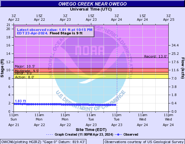
 Station image