Funding for this site is provided by:
 STATION.
--01531250 NB SUGAR CREEK TRIBUTARY NEAR
COLUMBIA CROSS ROADS, PA
LOCATION.--Lat 41`50'25", long
76`49'38", Bradford County, Hydrologic Unit 02050106, at
single-span concrete bridge on secondary road, 1.4 mi upstream from
mouth and 1.5 mi west of Columbia Cross Roads.
DRAINAGE AREA.--8.83 square miles.
PERIOD OF RECORD.--September 1962 to September 1968;
October 1968 to March 1981(partial record); May 2010 to current
year.
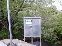
GAGE.--Water-stage recorder and crest-stage gage.
Datum of gage is 1,136.56 above National Geodetic Vertical Datum of
1929. Prior to May 13, 2010 water-stage recorder at datum 1.0 ft
higher. Satellite telemetry at station.
COOPERATION.--Station established and maintained by
the U.S. Geological Survey. Funding for the operation of this station
is provided by Repsol Oil & Gas USA.

