Funding for this site is provided by:
 STATION.
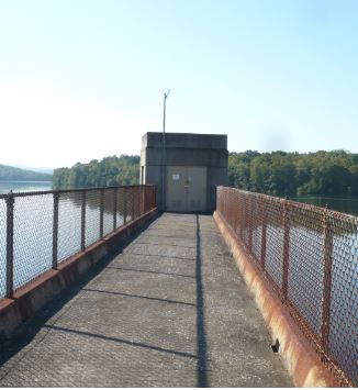
--01541340 GLENDALE LAKE, PA
LOCATION.--Lat 40`41'50", long
78`32'15", Cambria County, Hydrologic Unit 02050201, at
Glendale Dam on Beaverdam Run, 1.0 mi upstream from Dutch Run, 1.3 mi
southwest of Flinton, 1.9 mi above mouth, and 3.4 mi south of
Coalport.
DRAINAGE AREA.--41.9 square miles.
PERIOD OF RECORD.--January 1963 to current year.
GAGE.--Water-stage recorder. Datum of gage is the NGVD
1929.
REMARKS.--Reservoir is formed by an earth and rockfill
dam with ungated concrete spillway at elevation 1,435.00 ft. Storage
began December 1, 1960. Capacity at elevation 1,435.00 ft is 41,200
acre-ft of which 15,900 acre-ft is controlled storage above elevation
1,427.00 ft. Dead storage is 25,300 acre-ft. Reservoir is used for
flood control and recreation. Outflow is controlled by 72-inch gate and
an 8-inch bypass valve. Satellite telemetry at station.
COOPERATION.--Funding for the operation of this
station is provided by the Pennsylvania Department of Environmental
Protection and the U.S. Geological Survey.

