Funding for this site is provided by:
 STATION.
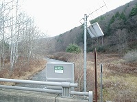
--01543693 EAST FORK SINNEMAHONING CREEK AT
WHARTON TOWNSHIP, PA
LOCATION.--Lat 41`32'29", long
77`58'49", Potter County, Hydrologic Unit 02050202, on left
bank on upstream side of bridge on State Route 3001, 2.5 miles upstream
from mouth.
DRAINAGE AREA.--49.2 square miles.
PERIOD OF RECORD.--October 2010 to current year.
GAGE.--Water-stage recorder and crest-stage gage.
Datum of gage is 1,170 ft above National Geodetic Vertical Datum of
1929, from topographic map. Satellite telemetry at station.
COOPERATION.--Station established and maintained by
the U.S. Geological Survey. Funding for this station is provided by the
Pennsylvania Department of Environmental Protection.
FLOOD STAGE.--No flood stage has been determined for
this station.

