LOCATION.--Lat 39°38'35.5", long 79°01'12.1", referenced to North American Datum of 1983,
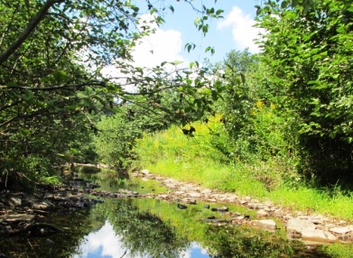
Garrett County, MD, Hydrologic Unit 02070002, on left bank at upstream side of bridge on Mt. Aetna Rd.,
0.10 mi upstream from Mudlick Run and 1.25 mi southeast of Avilton.
DRAINAGE AREA.--7.88 mi2, from automated delineation using 30-meter National Elevation
Dataset digital elevation model data dated 2011.
PERIOD OF RECORD.--July 2013 to June 2016 (discontinued).
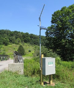
GAGE.--Water-stage recorder and crest-stage gage. Datum of gage is 2,251.39 ft above North
American Vertical Datum of 1988.
REMARKS.--U.S. Geological Survey satellite data-collection platform at station.
COOPERATION.--Funding for the operation of this station is provided by the Maryland Department of Natural Resources,
and the U.S. Geological Survey.
NOTICE--As of July 01, 2016, data
collection at this streamgage has been discontinued due to funding
reductions from partner agencies. Although historic data will remain
accessible, no new data will be collected unless one or more new
funding partners are found. Questions or concerns can be directed to
Jon Dillow (jjdillow@usgs.gov; 443-498-5524).