Funding for this site is provided by:
 STATION.
--03101500 SHENANGO RIVER AT PYMATUNING DAM,
PA
LOCATION.--Lat 41`29'53", long
80`27'37", Crawford County, Hydrologic Unit 05030102, on left
bank 500 ft downstream from Sugar Run, 900 ft downstream from
Pymatuning Dam, 1.5 mi northwest of Jamestown, and at mile 84.9.
DRAINAGE AREA.--167 square miles.
PERIOD OF RECORD.--June 1934 to current year.
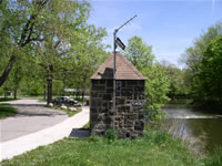
GAGE.--Water-stage recorder and concrete dam control.
Datum of gage is 969.4 ft above North American Vertical Datum of 1988.
Prior to January 8, 2024, the datum of gage was reported as 970.00 ft
above National Geodetic Vertical Datum of 1929. Satellite telemetry at
station.
COOPERATION.--Station established and maintained by
the U.S. Geological Survey. Funding for the operation of this station
is provided by the U.S. Army Corps of Engineers, Pittsburgh District,
the Pennsylvania Department of Environmental Protection, and the U.S.
Geological Survey.
REMARKS.--Flow regulated since 1933 by Pymatuning
Reservoir (Station 03100500).

