Funding for this site is provided by:
 STATION.
--400916076492301 YORK COUNTY, local well
number YO 1147.
LOCATION.--Lat 40`09'17.9", long
76`49'22.5", Hydrologic Unit 02050305, at I83 south rest stop
between exits 34 and 35.
OWNER.--Pennsylvania Dept of Transportation.
AQUIFER.--Gettysburg Formation, Triassic age.
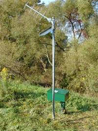
WELL CHARACTERISTICS.--Drilled observation well,
diameter 6 in, depth 182 ft, cased to 41 ft.
INSTRUMENTATION.--Data collection platform with
15-minute recording interval since April 2023; prior, 60-minute
recording interval. Satellite telemetry at station.
DATUM.--Elevation of land surface is 470 ft above
North American Vertical Datum of 1988, from Lidar. Measuring point: Top
of recorder shelf, 2.25 ft above land-surface datum.
REMARKS.--Daily maximum, minimum, and mean water
levels are available from the District Office.
PERIOD OF RECORD.--March 2001 to current year.
COOPERATION.--Funding for the operation of this
station is provided by the Pennsylvania Department of Environmental
Protection and the U.S. Geological Survey.

