LOCATION.--Lat 39°11'16.4", long 76°49'50.6", Howard County, MD, Hydrologic Unit 02060006, on
right bank, approximately 300 ft downstream from culvert on Oakland Mills Road, 1.1 mi north
of Guilford, and 0.3 mi upstream from mouth.
DRAINAGE AREA.--2.47 mi2, from automated delineation using 30-meter National Elevation
Dataset, digital elevation model data, dated 2007.
PERIOD OF RECORD.--October 2012 to present.
REVISIONS HISTORY.--https://waterdata.usgs.gov/nwis/dv/?site_no=01593450: 2017.
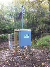
GAGE.--Water-stage recorder. Datum of gage is 298.89 ft above North American
Vertical Datum of 1988.
REMARKS.--U.S. Geological Survey satellite data-collection platform at station.
EXTREMES FOR PERIOD OF RECORD.--Maximum discharge, 2,730 ft³/s, July 29, 2017, gage height, 6.76 ft;
minimum discharge, 0.20 ft³/s, Nov. 19, 2016, Sept. 30, 2017.
COOPERATION.--Funding for the operation of this station is provided by the Columbia Association.