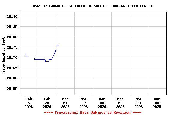
Most recent instantaneous value: 12.1 03-01-2026 02:30 AKST
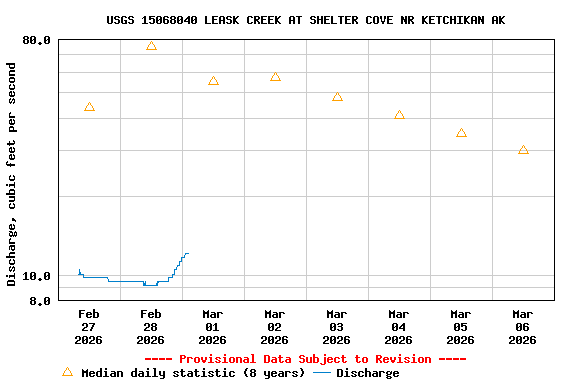
See this graph on the Monitoring Location Pages
| Min (2019) | 25th percen- tile | Most Recent Instantaneous Value Mar 6 | Median | Mean | 75th percen- tile | Max (2021) |
|---|---|---|---|---|---|---|
| 5.28 | 10 | 12.1 | 30 | 39 | 69 | 100 |