PROVISIONAL DATA SUBJECT TO REVISION
Click to hidestation-specific text
Funding for this site is provided by:
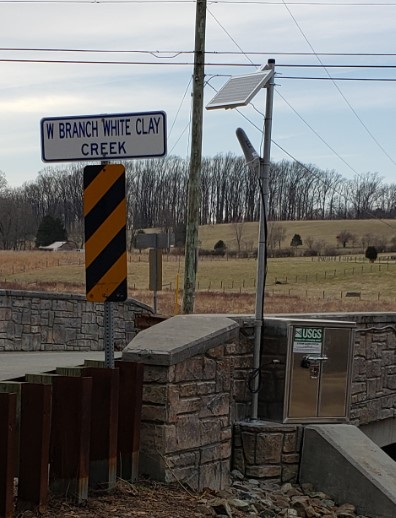 STATION.--01478220 WEST BRANCH WHITE CLAY CREEK NEAR
CHESTERVILLE, PA
STATION.--01478220 WEST BRANCH WHITE CLAY CREEK NEAR
CHESTERVILLE, PALOCATION.--Lat 39`45'56", long 75`47'47", Chester County, Hydrologic Unit 02040205, on the right bank, downstream side of N Creek Rd, 280 ft from the mouth, 1.5 miles southwest of Landenberg.
DRAINAGE AREA.--9.92 square miles.
PERIOD OF RECORD.--March 2020 to current year.
GAGE.--Water-stage recorder, crest-stage gage, and water-quality monitor. Datum of gage is 177.2 ft above North American Vertical Datum of 1988 from single-base GNSS rapid static survey. Satelite telemetry at station.
COOPERATION.--Station established and maintained by the U.S. Geological Survey. Funding for this station is provided by the U.S. Geological Survey.
Summary of all available data for this site
Instantaneous-data availability statement