USGS 13046995 FALL RIVER AB YELLOWSTONE CANAL NR SQUIRREL ID

PROVISIONAL DATA SUBJECT TO REVISION

Click to hidestation-specific text
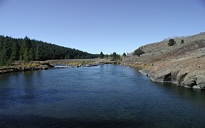
Falls River above Yellowstone Canal near Squirrel, ID - USGS file photo

> Rating Information


Station operated in cooperation with Water District No.1.

Station operated with funding provided by the U.S. Geological Survey Groundwater and Streamflow Information Program (GWSIP).

This station managed by the Idaho Falls Field Office.

Available Parameters Available Period
  
1994-07-21  2026-05-25
2007-10-01  2026-05-25


 (7)
 

  -- or --


Summary of all available data for this site
Instantaneous-data availability statement


Discharge, cubic feet per second

Most recent instantaneous value: 1000 05-25-2026   04:45 MDT
Graph of  Discharge, cubic feet per second

Add up to 2 more sites and replot for "Discharge, cubic feet per second"

?


Create presentation-quality / stand-alone graph.   Subscribe to WaterAlert      

See this graph on the Monitoring Location Pages


Daily discharge, cubic feet per second -- statistics for May 25 based on 32 water years of record more
Most Recent
Instantaneous
Value May 25
Min
(2022)
25th
percen-
tile
Median Mean 75th
percen-
tile
Max
(1997)
1000 1090 1740 2210 2370 2840 4840


Gage height, feet

Most recent instantaneous value: 6.41 05-25-2026   04:45 MDT
Graph of  Gage height, feet

Add up to 2 more sites and replot for "Gage height, feet"

?


Create presentation-quality / stand-alone graph.   Subscribe to WaterAlert      

See this graph on the Monitoring Location Pages