PROVISIONAL DATA SUBJECT TO REVISION
Click to hidestation-specific text
 Rating Information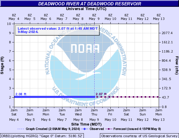
Station operated in cooperation with U.S. Bureau of Reclamation.
Station operated with funding provided by the U.S. Geological Survey Groundwater and Streamflow Information Program (GWSIP).
Realtime Gage Height data is provided by U.S. Bureau of Reclamation (USBR) telemetry . In the event of equipment malfunction, estimates of releases may be found here
Summary of all available data for this site
Instantaneous-data availability statement


