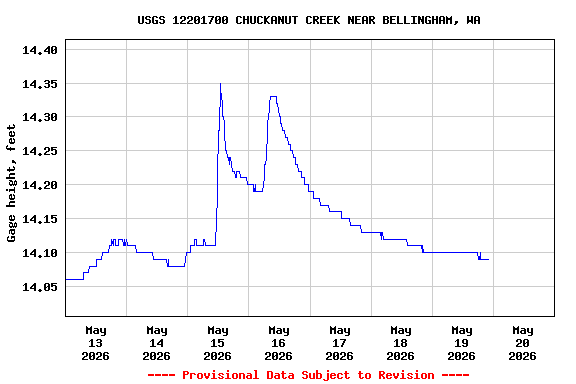
Most recent instantaneous value: 0.58 05-19-2026 22:00 PDT
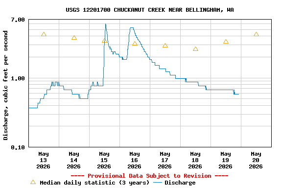
See this graph on the Monitoring Location Pages
| Most Recent Instantaneous Value May 20 | Min (2023) | 25th percen- tile | Mean | Median | 75th percen- tile | Max (2025) |
|---|---|---|---|---|---|---|
| 0.58 | 2.20 | 2.2 | 3.6 | 4.2 | 4.3 | 4.34 |