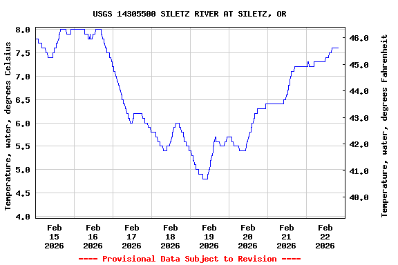
Most recent instantaneous value: 7.6 02-22-2026 17:30 PST
See this graph on the Monitoring Location Pages
Station funded by U.S. Geological Survey National Streamflow
Information Program (NSIP).
NOTE: River forecasts and additional data can be obtained at the
National Weather Service's Advanced Hydrologic Prediction Services web page.

NOTE: The most current shifted rating for this site can be found at USGS Rating Depot website.
| Boating safety tips |
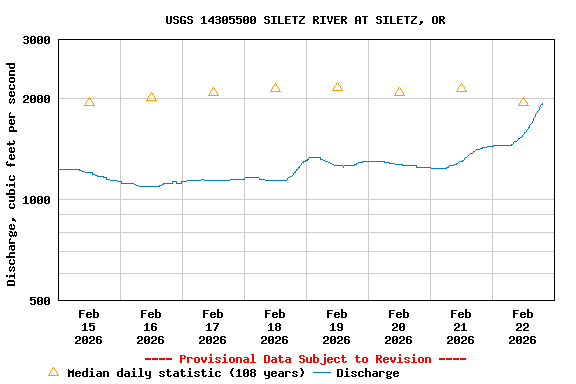
| Min (1934) | 25th percen- tile | Most Recent Instantaneous Value Feb 22 | Median | Mean | 75th percen- tile | Max (1949) |
|---|---|---|---|---|---|---|
| 450 | 1240 | 1830 | 1950 | 2940 | 3470 | 18000 |
![]() U.S. Department of the Interior |
U.S. Geological Survey
U.S. Department of the Interior |
U.S. Geological Survey
Title: USGS Surface-Water Historical Instantaneous Data for the Nation
URL:
Page Contact Information: Oregon Water Data Support Team
Page Last Modified: 2026-02-22 21:27:09 EST
1.2 0.86 caww01