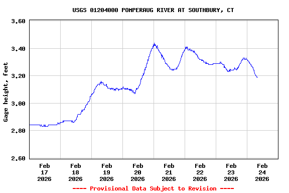
Most recent instantaneous value: 95.0 02-24-2026 07:00 EST
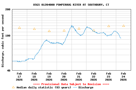
See this graph on the Monitoring Location Pages
| Min (1968) | 25th percen- tile | Most Recent Instantaneous Value Feb 24 | Median | Mean | 75th percen- tile | Max (1981) |
|---|---|---|---|---|---|---|
| 40.0 | 77 | 95.0 | 129 | 185 | 230 | 1260 |