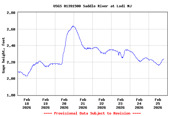
Most recent instantaneous value: 86.8 02-25-2026 17:30 EST
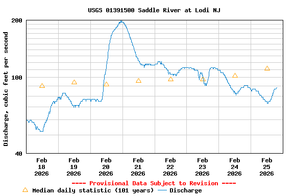
See this graph on the Monitoring Location Pages
| Min (2002) | 25th percen- tile | Most Recent Instantaneous Value Feb 25 | Median | 75th percen- tile | Mean | Max (1977) |
|---|---|---|---|---|---|---|
| 29.5 | 73 | 86.8 | 111 | 153 | 156 | 2050 |