PROVISIONAL DATA SUBJECT TO REVISION
Click to hidestation-specific text
Funding for this site is provided by:
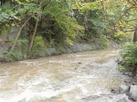 STATION.--01476480 RIDLEY CREEK AT MEDIA, PA
LOCATION.--Lat 39`54'58", long 75`24'13", Delaware County, Hydrologic Unit 02040202, on right bank 400 ft downstream from bridge on U.S. Highway 1 (Baltimore Pike) at Media.
DRAINAGE AREA.--30.5 square miles.
PERIOD OF RECORD.--October 1986 to September 1995, October 1995 to December 1996 (fragmentary), January 1997 to current year.
GAGE.--Water-stage recorder and crest-stage gage. Datum of gage is 100.0 ft. above North American Vertical Datum of 1988, from single-base GNSS static survey. Prior to September 23, 2024, the datum of gage was erroneously reported as 110 ft above National Geodetic Vertical Datum of 1929. Satellite telemetry at station.
COOPERATION.--Funding for the operation of this station is provided by the Delaware River Basin Commission.
Summary of all available data for this site
Instantaneous-data availability statement


