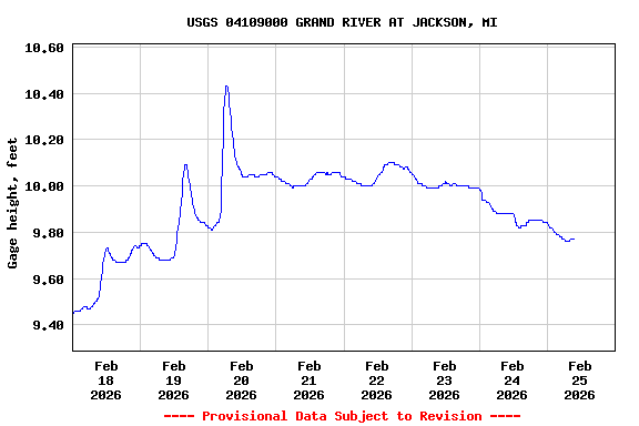
Most recent instantaneous value: 131 02-25-2026 08:30 EST
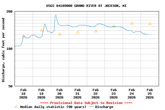
See this graph on the Monitoring Location Pages
| Min (1964) | 25th percen- tile | Most Recent Instantaneous Value Feb 25 | Median | Mean | 75th percen- tile | Max (2018) |
|---|---|---|---|---|---|---|
| 33.0 | 105 | 131 | 158 | 191 | 253 | 626 |