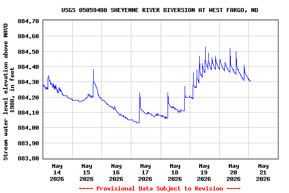
Most recent instantaneous value: 0.00 05-21-2026 01:15 CDT
See this graph on the Monitoring Location Pages
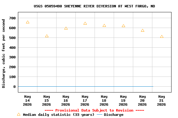
| Most Recent Instantaneous Value May 21 | Min (1993) | 25th percen- tile | Median | Mean | 75th percen- tile | Max (2022) |
|---|---|---|---|---|---|---|
| 0.00 | 0.00 | 37 | 509 | 912 | 1450 | 4700 |
![Graph of Gage height, feet, [(2)]](https://natwebsdww01.cr.usgs.gov/nwisweb/data/img/USGS.05059480.92493.00065..20260514.20260521..0..gif)